Green Remediation Focus
California Gulch Superfund Site
Leadville, Colorado
Superfund NPL
Cleanup Objectives: Address metals contamination caused by past mining activities on this 18-square-mile site by: minimizing human exposure to heavy metals, minimizing erosion of fluvial mine waste deposits into surface water (the upper Arkansas River), controlling leaching and migration of metals, reducing toxins in plants, and reducing exposure of wildlife and livestock to heavy metals in soil and vegetation.
Green Remediation Strategy: Use a five-pronged approach initially targeting onsite meadows and tailings areas along the river at "Operable Unit 11" of this high-elevation site (more than 10,000 feet above mean sea level) and involving:
- Minimizing excavation and offsite disposal of contaminated soil, through in situ application of soil amendments
- Choosing soil amendments consisting of biosolids or agricultural and forestry byproducts rather than synthetic products or newly quarried materials to restore soil quality and re-establish native vegetation in denuded areas
- Minimizing additional disturbance to the soil profile and salvaging existing vegetation
- Maximizing use of available onsite plant materials and rocks rather than imported materials to stabilize river banks
- Integrating remediation processes with restored use of the land for agricultural and recreational purposes and by native wildlife
Results:
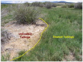
- Conducted a field demonstration involving soil amendments containing conventional agricultural lime plus biosolids from a wastewater treatment plant; results were used to plan full-scale application of soil amendments containing organic-rich material with a longer lifespan
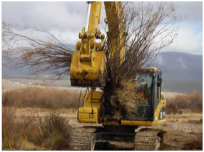
- Salvaged onsite timber and native plants from floodplain areas for use in bank stabilization prior to full-scale amendment operations
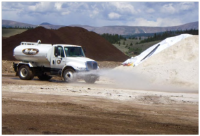
- Used sugar beet lime (obtained from a former sugar beet process plant undergoing cleanup as a brownfield) rather than conventional quarried lime to raise soil pH and increase microbiological activity in the soil, consequently fostering plant growth; when compared to applying conventional dry lime, application of the sugar beet lime resulted in less dust generation and greater ease of application due to its high (approximately 20%) moisture content
- Performed full-scale organic amendment of the soil through use of compost consisting of livestock manure mixed with wood waste
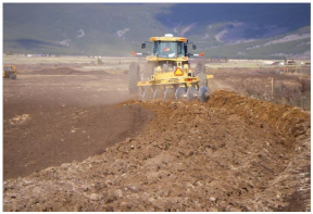
- Mixed the amendments directly into soil on 153 acres of irrigated meadow through use of a tractor-pulled plow extending to the full depth of contamination (< 12 inches below ground surface) rather than through non-surgical excavation of soil for ex situ mixing
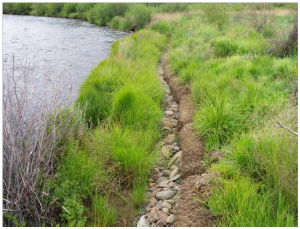
- Installed bendway weirs (low-profile rock sills) and root wads to protect riverbanks and enhance fish habitat in selected locations, rather than constructing armored banks with riprap or gabion baskets more likely to alter the natural flow of water
- Used local borrow soil and rock, including large rocks segregated during in situ soil mixing, rather than imported materials for backfill as needed
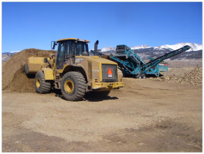
- Re-mined placer tailings to obtain soil and rock suitable for use as aggregate in onsite roads for remedy construction, while reclaiming the former tailings area for productive use f Avoided mobile source air emissions associated with offsite disposal of contaminated soil that was instead amended in situ
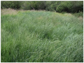
- Selected native species and non-invasive hardy grasses for re-seeding purposes throughout the soil amendment areas, which covered a total of approximately 170 acres
- Constructed remediation-purposed roads in optimal locations to minimize impacts on bird habitat and reused some roads for long-term recreational use and access to fishing areas
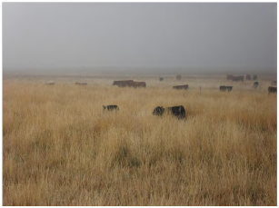
- Relied on extensive community input and cooperation for the integrated remediation-reuse plan, including private-party donation of land and construction material for the initial biosolids demonstration and implementation of controlled grazing plans in restored meadows
- Coordinated closely with government partners to assure remediation activities complemented regional master plans established by the U.S. Fish and Wildlife Service, U.S. Bureau of Land Management, Colorado Department of Public Health and Environment, and Colorado Division of Natural Resources
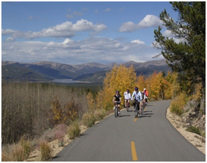
- Began evaluating other methods for material or waste reuse at other operable units. For example, slag-contaminated soil was consolidated into a platform running along the site's former rail and haul-road corridor (passing through operable units 3,4,6, and 9) to provide a base for soil capping; the platform was covered with a 6-inch-thick, 12-foot-wide layer of gravel followed by a 6-inch layer of asphalt that now serves as a recreational trail surface
- Transitioned responsibility for long-term maintenance of the soil cap/trail to local government stakeholders (Lake County) as part of regional efforts focusing on historic preservation, recreation opportunities, and enhanced tourism
- As of September 2022, institutional controls are being prepared (but are not yet implemented) at OU11 to reduce exposure to lead in the event land use were to change to residential.
Property End Use: Agriculture and recreation
Point of Contact: Mike Holmes, U.S. EPA Region 8
Update: July 2024

